The myth of the Greater Antilles
Similar to the often mythically glorified and legendary island kingdom of “Atlantis”, which, according to a description by the Greek philosopher Plato from the 4th century, is said to have been a globally important maritime power about 12,000 years ago, but which was destroyed by a severe natural disaster, the phantom island “Antilia”, which was first shown on maps in Europe in the 15th century, probably never existed.
Also referred to as “Ilha das Sete Cidades” (Island of the Seven Cities) in contemporary Arabic and Portuguese sources, it is located approximately at the 31st parallel in the region of today’s Cuba However, in view of the many submarine mountain peaks, freshwater springs and volcanic layers in the tectonically still very active Caribbean, this legendary island might have had a real model after all. Regardless of this question, which has not yet been fully clarified, the island of “Antilia” nevertheless founded the name of the Caribbean archipelago of the Antilles as part of the West Indies off the coasts of Central and South America, according to an assumption accepted by the majority of scholars.
The Greater Antilles are now the largest and most populous part of the Caribbean
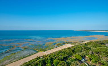
When Christopher Columbus first set foot on the eastern Bahamas island of Guanahani (San Salvador) during the discovery of what would later become America, in October 1492, and at the end of December of the same year he also set foot on Hispaniola and Cuba, he and his crew will in all probability have been familiar with the legend about “Antilia”, which was widespread at that time. Initially, however, all islands in the Caribbean were referred to by the Spanish conquerors as Leeward Islands (“Islas de Barlovento”). The British also called the islands in the 18th century mostly “Forward Islands”, the name and the geographical distinction between Greater and Lesser Antilles has only been known since the beginning of the 19th century. Today, the Greater Antilles in the west of the Caribbean, consisting of the islands and archipelagos of Cuba, Hispaniola, Jamaica, Puerto Rico, Navassa and Cayman Islands with over 207,000 km² and together currently about 38 million inhabitants, each form around 90 percent of the area and population of all West Indies.
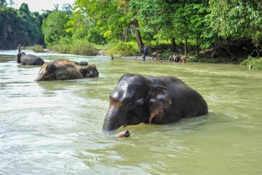
Cuba: The largest island in the Antilles has an extremely eventful history
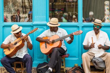
With an area of almost 110,000 km² and currently over 11 million inhabitants, the largest island of the Greater Antilles is by far the most famous island in the entire region in terms of landscape, culture, tourism and, last but not least, politics. A Spanish colony from the early 16th century until 1898, Cuba was under US control for a long time until the successful revolution in 1959, despite formal independence. After decades of support from the Soviet Union, the island suffered great economic hardship after the end of the “Eastern Bloc” in the early 1990s in the “Special Period in Peacetime”.
In response, the last officially socialist country in the Western world was opened up to international tourism. In addition to the equally sophisticated and morbid capital Havana, Santiago de Cuba as the second largest city, Cienfuegos on the southern Caribbean coast as well as Santa Clara with Che Guevara’s tomb and Trinidad with the center protected as a UNESCO World Heritage Site are among the most visited destinations.
Cayman Islands: As a thank you for sea rescue, the king donated tax exemption
The Cayman Islands, consisting of Grand and Little Cayman as well as Cayman Brac and together about 264 km² in size, are located 350 kilometers south of Cuba. First discovered by Europeans and named “Las Tortugas” because of the many turtles, the archipelago was discovered during Christopher Columbus’ fourth voyage of discovery in May 1503. They got their name “Las Caymanas” because of the numerous pointed crocodiles living there in the early 17th century.
English rule began in 1670, and the first settlements and plantations with African slaves were established from 1730 onwards. According to legend, the current status as a tax haven was granted as early as 1794 by the then British King George III as a thank you for the rescue of a fleet of ships in distress by the islanders. The islands became a crown colony in 1863, still administered jointly with Jamaica, and since 1962 they have been an independent overseas territory of the United Kingdom. Today, bathing and diving tourism in particular play important roles. Well-known and much-visited destinations include Seven Mile Beach, Stingray City and Queen Elizabeth II Botanic Park, the Cayman Turtle Centre, and the Salina Reserve and Cayman Island Marine Park marine reserves.
Jamaica: Rasta, reggae, rum and ritual smoke have made the island famous
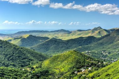
With an area of almost 11,000 km², the third largest island in the Greater Antilles is currently home to a good 2.7 million inhabitants, more than 90 percent of whom are of African origin. Jamaica is located about 150 kilometers south and west of Cuba and Hispaniola, despite its relatively small size, the island, which is comparatively young in terms of geological history, has amazingly diverse and different landscapes. The interior of the island is dominated by mountain ranges up to more than 2,200 meters high, such as the Blue Mountains in the east and known as a growing area for the exquisite and expensive coffee variety “Jamaican Blue Mountain”. The coasts of the island are mostly much flatter, dreamlike tropical beaches like from a picture book are for example Doctor’s Cave Beach Club in Montego Bay, Bluefields Beach Park in Westmoreland and Reggae Beach between Ocho Rios and Oracabessa on the north coast, named after Jamaica’s musical export hit. The genuinely Jamaican style of music, cultivated by the Rastafarian religious community that emerged on the island in the 1930s, also became globally popular in the 1970s. Often adorned with imposing “dreadlocks” (felt curls), most Rastas reject the consumption of the excellent rum from Jamaica, but like to enjoy the cannabis they call “ganja” and revered as sacred and healing.
Navassa Island: The tiny uninhabited island is strategically important at best
The only 5.4 km² in size, first entered in 1504 by stranded Spanish sailors and built in the second half of the From the 19th century to 1898, the island, which was intensively used for the mining of the naturally occurring fertilizer phosphorite, had been used since the early In the 20th century, it was only sporadically inhabited by a few U.S. military personnel and scientists. Since December 1999, Navassa Island has been completely protected as a “United States Minor Outlying Island” claimed by the USA and may not be entered.
As a travel destination, the lonely island a good 54 kilometers from the westernmost point of Haiti is therefore not of interest. However, the island has strategic value for the United States due to its proximity to the notorious “Guantanamo Bay Naval Base” on the southeast coast of Cuba. Navassa made headlines in 1996 and 2005 when a documentary filmmaker and a former Somali honorary consul ultimately tried unsuccessfully to assert territorial claims in court or with the establishment of a micronation.
Hispaniola: Two relatively different brothers share the Caribbean “Spain” today
With an area of almost 76,500 km², the second largest island in both the Greater Antilles and the West Indies between Cuba, Jamaica and Puerto Rico was populated by up to three million members of the Arawak and Ciboney Indian peoples until the arrival of the Spaniards in 1492. After the beginning of Spanish colonial rule in the 16th century, their number decreased rapidly to almost complete extinction due to imported epidemics and inhumane slave labor.
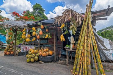
Various bloody uprisings by indigenous and black slaves, raids by pirates, armed conflicts between the fiercely competing colonial powers Spain and France , as well as civil wars and natural disasters shaped Hispaniola’s eventful history until the middle of the 19th century. Since 1844, the smaller Haiti in the west and the Dominican Republic in the east, which is almost twice as large, have shared the island. The latter in particular, with its tourist centres Puerto Plata, Samaná, Punta Cana and Bávaro, has developed into a popular destination for beach holidays since the 1980s. Other popular destinations in the “Dominican Republic” are Cabarete, Playa Dorada and Las Terrenas, as well as Bayahibe, Barahona, Boca Chica and Río San Juan. In Haiti, which is much poorer and less developed in terms of infrastructure, the beautiful beaches at Cape-Haïtien in the north and the cities of Jacmel and Port Salut as well as the small island of Île à Vache in the south are well-known and well-visited holiday areas.
Puerto Rico: The Caribbean outpost of the USA is a small but fine destination
Puerto Rico, the smallest island in the Greater Antilles with an area of more than 9,000 km² and currently about 3.2 million inhabitants, is a majority Spanish-speaking territory of almost 95 percent of the United States of America, which has not been incorporated since 1898. Although the dollar is the official currency and all Puerto Ricans have had US citizenship since 1917, the island is not yet an official federal state.
With up to 3.7 million foreign visitors per year, Puerto Rico is not only a popular destination for US citizens, but also for numerous European guests, primarily from France, Great Britain and Germany . The most famous beaches, as well as those best equipped with gastronomy and accommodation, are Balneario de Rincón Boquerón (Cabo Rojo), El Tuque (Barrio Canas), Cayos de Caña Gorda (Guánica), Crash Boat Beach (Aguadilla) and Flamenco Beach in Culebra, as well as Playita del Condado and the approximately 40 different stretches of beach around the town of Ponce on the south coast. The historic center of the capital San Juan, the partially accessible cave system in the Parque de las Cavernas del Río Camuy in the northwest and the ecologically interesting El Yunque National Park in the northeast are also recommended for excursions.