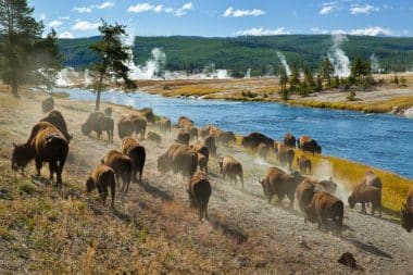
When explorers in the United States set out west from the East Coast to discover new land, they were fascinated by the endless expanses between the two oceans. As the caravans of settlers moved through Nebraska, they were greeted not only by the Sand Hills, but also by the breathtaking scenery of the Rocky Mountains, water buffalo and, above all, a seemingly endless landscape. While the buffalo have almost completely disappeared over the years, the state is still closely connected to the Rocky Mountains. And even though Nebraska is not a classic state for tourists, some would even mockingly call it a fly-over state, there is a lot to discover for the curious eye where the settlers marched west.
Between Route 66 and natural spectacle
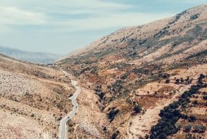
The state of Nebraska is not necessarily known as a place for huge cities. Omaha is a very lively capital city worth visiting, but of course it can’t be compared to famous metropolises like New York, Los Angeles or Miami . The treasure of Nebraska is nature. And that doesn’t even mean the Rocky Mountains, but pretty much everything you can explore by car in the state. The vast steppes with their breathtaking rock formations are worth a visit, as are the reserves of the few remaining indigenous peoples, who show their visitors how people lived here long before the Europeans came to conquer the continent.
Top attractions outside the Rockies include Scotts Bluff National Monument and Chimney Rock National Historic Site. Both are huge rock formations that can be found in the middle of the steppe. Their special feature is not only given by their striking appearance, but also by the fact that they were an important symbol for the settlers on their way west. They were used to orient oneself on the way and some of the wagon tracks of the former settlers can still be found today – in addition, there are small museums and exhibitions that remember the life of the settlers on the way to the coasts in the west.
While you can follow the famous Oregon Trail of the settlers in these places, there is another popular road in Nebraska: Route 66. Here, important parts of the important road run through the United States and diners, museums and shops remind us of the historical history of the route. If you are traveling by car or motorcycle, you should definitely have taken the chance to have ridden on the route once.
Top things to see and do in Nebraska
One of the most important sights of Nebraska is the natural spectacles. This is a nice contrast to the visits to the often crowded cities of the United States, which can quickly trigger a sensory overload. Instead, you have the opportunity not only to see the aforementioned National Monuments and the Rocky Mountains, but also to follow in the footsteps of the settlers who once discovered the country with excursions. Whether on horseback or with a tour in the car – a journey through the steppes of Nebraska, to the lakes and rivers of the state, gives a feeling of the incredible vastness that people must have experienced when discovering the USA .
Whether you opt for the real experience on the Oregon Trail or eat a stew to your liking at Buffalo Bill’s house, the options for activities and excursions are numerous in Nebraska, and they are always connected to nature and the state’s historical history. It is recommended that you take a rental car in Omaha or Lincoln for the duration. The distances in the state should not be underestimated and it can happen that you drive for several hours through almost deserted areas until you arrive at the next sight.
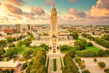
Omaha and Lincoln as a center for one’s own planning
With Omaha and the state capital Lincoln, there are two cities that are particularly interesting for a visit. While Lincoln is the political and administrative center of Nebraska, one’s own life takes place primarily in Omaha. The city of Omaha has a quite impressive skyline for its small size and is home to some of the most important sights for visiting the state, especially with the famous zoo and some museums. But beyond that, it is above all an experience for the other side of Nebraska. The restaurants and diners, the theaters and cinemas, all of this conveys a bit of the attitude to life in the center of the USA. The steaks are huge, the cars as well and the people here couldn’t be typically American. It can therefore be worthwhile to spend a few days in the cities after a trip through the special nature and let this other side of the USA work its magic on you before you make your way to the next destination in the USA.