The state of Maryland belongs to the so-called Capital Area and, together with Virginia, is one of the states that surround the capital Washington D.C. Therefore, a connection with the important capital, but also with its neighbor Virginia , is already historically determined. But that doesn’t mean it’s not worth taking a trip to Maryland and exploring the state on your own. As one of the oldest states in the USA , the country’s history is also closely linked to the state and the cuisine in particular has an excellent reputation here. Plus, nature is perfect for escaping the hustle and bustle of D.C.
Maryland – the Chesapeake Bay State
There are many names for Maryland, but the term Chesapeake Bay State probably makes the most sense. This refers to the many stretches of coast, small rivers and lakes and the fact that the country is a mixture of huge swamp and flourishing nature. This was probably one of the reasons why the first Catholic settlers in the New World settled here. For many years, Maryland was the only Catholic state among the otherwise Protestant new states in the USA and therefore also a place of refuge for many people from Europe who fled the Reformation. As a result, many of today’s inhabitants of the USA can trace their ancestors back to people who set foot on the new continent here.
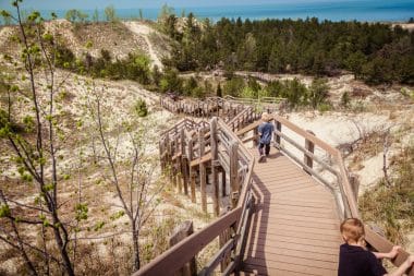
Maryland is definitely not one of the classic travel destinations in the USA and in fact only a few tourists get lost so high north. There is also a lot to discover here. The state is primarily aimed at day-trippers who want to escape the narrow streets of Washington D.C. or people who live in Baltimore, Maryland’s largest city, and want to treat themselves to a little fresh air and nature. Because nature will certainly be found on every corner here.
State of fishing villages and coastal towns
Unlike many other countries, there are no large canyons or huge national parks where you can spend whole days. The charm of the comparatively small state of Maryland comes mainly from the many small villages and towns that line the coast, the Chesapeake Bay State. The best tour is undoubtedly by car, because getting around by train or bus is hardly possible in the state. In addition, you are most flexible with your own car and can also move into the terrain if you want to take a trip to one of the historical sites.
The drive along the coast leads past houses in the Founder’s House style, which are exemplary with their white domes and red brick facades. On the side of the sea, you will actually see fishermen at any time, who are just about to reel in the catch of the day or are already on their way back to sea. One of the many advantages is that you can also find a good restaurant right on the coast every few kilometers where you can enjoy the freshest seafood. Especially the lobster, the lobster, is recommended here. The entire region is known for the sweet-tasting lobster. But mussels and crabs are also among the delicacies that are prepared with all cordiality in the small restaurants.
By the way, if you like sailing, you will find plenty of opportunities for it here in the many clubs and coastal villages. The rental of ships is actually a tradition. If you don’t feel safe all alone on the foreign sea, you can also take one of the many offers for tours, which are usually also linked to food and drink or lead to one of the restaurants mentioned at the end of the day.
Annapolis and Baltimore – the two most important cities of Maryland
The state capital of Annapolis is one of the highlights of a trip through Maryland. This is where the state was born and has always been administered from here. Some of the old buildings from the Wilhelminian period are still the most important sights today. The State House and the old post office show what it looked like here around 200 years ago. In addition, Annapolis is comparatively modest and offers many interesting opportunities for shopping, visiting restaurants and a relaxed stroll through the streets.
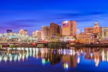
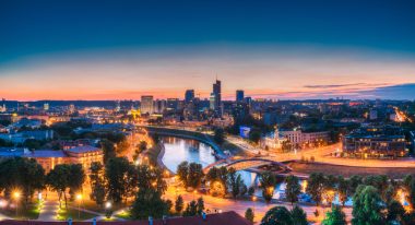
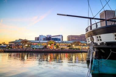
It’s a bit different in Baltimore. The city exudes much more of the charm of a metropolis, has a pretty skyline and is also one of the former industrial centers of the USA. The cathedral in particular, which is a final testimony to the state’s former Catholic heritage, is worth a visit. For many years, it was the only cathedral in the U.S. and the most important church for people with a Catholic faith. A stroll along the harbour alone is worth a visit. Then don’t miss out on checking out the USS Constellation – the Civil War-era ship is an important relic of American history and the museum offers a great insight into a part of history that is still difficult for many Europeans to grasp today.