


The Portuguese flower island of Madeira is suitable for fantastic hikes along a colourful world of flowers in lush, green nature with a view of spectacular cliffs. The climate is mild all year round, so the splendour of the flowers is correspondingly lavish at any time of the year. Some of the hikes lead along the unique levadas. These are Madeira’s typical irrigation canals that run over terraces through fertile cultivated land. The untouched nature offers valleys with subtropical vegetation, rushing waterfalls and barren mountain slopes and rugged cliffs at the summit of Pico Ruivo.
An example of a hiking trip to Madeira could look like this:
The best way to get there is by plane. The destination airport belongs to the island’s capital Funchal. It is an interesting airport, partly it stands above the sea on stilts. A drive leads from there to the quiet little town of Santana, which lies above the sea on a plateau and is an ideal starting point for tours along the north coast. In Santana, the Casas de Colmo are a tourist attraction: the traditional, thatched wooden houses are typical of Madeira.
Hike from Santana to São Lourenço
A suggestion for the first hike would be a tour along the wildly romantic coastal landscape that lines the São Lourenço peninsula. Here the land ends abruptly at a steep rock face that plunges directly into the sea from a height of 180 meters. A spectacular cliff path leads there with magnificent views over the Atlantic. The path leads down to the fine sandy lava beach of Prainha, which is one of the best bathing opportunities in Madeira. The environment is otherwise barren and thus stands in contrast to the otherwise very lush vegetation of the island. Depending on your condition, the hike takes two to three hours with a total length of eight kilometers, on which 180 meters of altitude have to be overcome.
Hike from Queimadas to Ilha and drive to Porto Moniz
It is a good idea to take the bus from Santana to Queimadas inland, where a five-hour hike can begin. It leads over the Caldeirão Verde mountain on levada paths to a spectacular waterfall. For a long time we walk through an unspoilt forest and through mysterious tunnels (flashlight or headlamp required) until it reveals the view of the sea and the north coast of Madeira. The tour leads 50 meters up in altitude and 530 meters down to the destination, where you can take a bus ride to the fishing village of Porto Moniz, which enchants its guests with a beautiful waterfront.
Hike from Porto Moniz to Ponta do Sol
From Porto Moniz, a hike leads along the Levadas Moinho and Levada do Risco to Ponta do Sol. These two levadas (irrigation canals, see above) have their charming peculiarities. There are many watermills on the Levada Moinho, and the Levada do Risco, located at an altitude of 1,000 meters, is surrounded by a blooming heather landscape. On the way we pass an impressive double waterfall, whose enormous power created a crevice in the rock. Shortly before Ponta do Sol we reach a laurel forest, as it is so characteristic of Madeira.
Two-day hike from Ponta do Sol to Funchal
This tour is something for hikers with a good level of fitness. From Ponta do Sol, the “place of the sun” on Madeira’s south coast, it is best to set off early in the morning. An old pilgrimage route leads from Boca da Corrida to the Pico Grande mountain. At the starting point, you can also see the Curral das Freiras (“Valley of the Nuns”) in the basin in front of the mountain. Along the steep mountain walls, a mule track leads first to a beautiful viewpoint and after a maximum of five hours to the Encumeada Pass at an altitude of 1,000 meters. This connects the north and south of Madeira. There are 500 meters of altitude to overcome on the 13 kilometers of ascent and 300 meters of descent. The first day of this challenging hike can optionally end here in a small guesthouse, but with good physical condition, another ascent is also possible. The intermediate destination is the Pico do Arieiro at 1,818 meters above sea level.
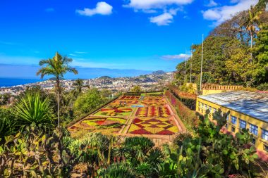
If you take it a little easier, prepare for the overnight stay now and let yourself be driven up to Pico do Arieiro the next morning, which is also possible from higher points for the very sporty hikers. There are mountain huts with overnight accommodation everywhere, but a guided tour or very good information in advance is necessary. The next day, the ascent from Pico do Arieiro to Pico Ruivo (Red Peak) begins at 1,862 meters above sea level. This highest mountain in Madeira is the geographical peak of the trip. The views on the two hikes are truly spectacular. The island administration has had good paths laid out, which is why the hikes require a lot of stamina, but can be considered very safe. In the early afternoon, the descent to Funchal begins, which is also demanding. There is at least one more day to visit the city, which is beautifully situated on a bay.
Journey home and conclusion
From Funchal, it would be possible to travel home by plane. The hiking tour to Madeira described here is relatively short: It is also possible to hike on the island for four weeks at a time and always discover something new.