Although the first Europeans discovered and explored the more than 100 atolls and islands of the five archipelagos in the South Pacific before him, the arrival of the naval officer, navigator and writer Louis Antoine de Bougainville (1729-1811) in Tahiti in April 1786 is considered the birth of the 4,100 km² overseas territory of French Polynesia. Its 118 inhabited and uninhabited islands are spread over approx. 4,000,000 km² of water surface and belong to the Austral, Gambier, Society and Marquesas Islands and the Tuamotu archipelago with currently a total of almost 276,000 inhabitants.
Of these, almost 90 percent (243,000) live on the 14 “Îles de la Société” (Society Islands) around Tahiti, which are divided into the two subgroups “Îles du Vent” and “Îles sous le Vent”, as the largest island in French Polynesia with an area of 1,042 km² and currently almost 193,000 inhabitants. Tahiti, with its typical black sand beaches, is also by far the best-known, most popular and most visited destination in the region for foreign visitors. Of the approximately 165,000 guests per year, over 80 percent are drawn there.
Long-distance travellers from Europe are mainly drawn to Tahiti, Bora-Bora and Moorea

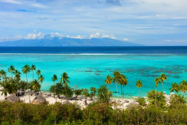
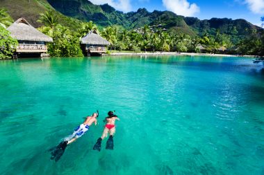
But the rest of the islands of French Polynesia and the Society Islands in particular are also very popular among holidaymakers. In recent years, the most visitors have been recorded in particular to the 38 km² Bora Atoll , annexed by France in 1880, around the 727-metre-high mountain Mont Otemanu with a good 10,000 inhabitants, mainly in its capital Vaitape, as well as the much larger island of Moorea with an area of 134 km² and currently almost 18,000 inhabitants. While the smaller Bora-Bora as one of the Leeward Islands with its fantastically tropical picture-book beaches and bays including numerous hotels and bungalows built on stilts in the water has long been one of the most exclusive and luxurious, but with high three-digit daily prices (euros) also the most expensive travel destinations and holiday resorts on earth, the price structure on Moorea (Leeward Islands) is at least in some places a little cheaper in terms of approach and comparison. As early as the early 19th century, European travelers raved about the scenic beauty of the island, also known as the “little sister of Tahiti”. The English author William Ellis (1794-1872) praised the island, which lies within sight of Tahiti and is only separated from its west coast by a 17-kilometre-wide strait, as the most beautiful of all the Society Islands.
On Moorea, visitors sometimes need rain protection, but not warm clothing
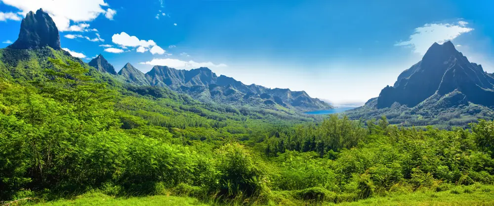
In fact, Moorea and its surrounding and uninhabited “motus” (reef islands) Fareone and Tiahura boast a truly impressive number of majestic natural and impressive cultural monuments. Geographically, the island, which according to a legend of the indigenous people was formed from the dorsal fin of a fish and has an almost triangular shape, is characterized by the two bays “Baie de Cook” and “Baie d’Opunohu” on the north coast, which extend far inland, as well as a V-shaped mountain range in the center with the highest mountain, Mont Tohiea (1,207 meters).
Just like it, Mont Rōtui (899 meters) and Mont Tautuapae (769 meters) are the remains of an extinct volcano that formed the island two million years ago. The steep to vertical mountains of Moorea are unsuitable as destinations for ascents or hikes, but they are all the more suitable as photo motifs. The typical tropical climate here is humid and warm, with monthly average temperatures ranging from a pleasant 24 to 30 degrees Celsius over the course of the year. A relatively large amount of rain falls from December to February, and it is much drier between July and September. The wind constantly blowing from the sea provides refreshment.
Leisure fun on the coasts of Moorea is provided by dream beaches and water sports

Much more important for tourism than the mountainous interior of the island, which is partly not accessible at all or only accessible by off-road vehicles or donkeys and horses, is the densely populated coast with the towns of ‘Āfareaitu, Ha’apiti, Maharepa, Paopao, Papeto’ai, Te’avaro as well as Ti’ai’a and Vai’are, where most of Moorea’s inhabitants live and where most of the accommodation is located.
The largest districts of the municipality of Moorea-Maiao are Paopao on the northeast coast with 4,600 inhabitants, from where interesting dives through the coral reefs in the Baie de Cook are offered, Ha’apiti on the southwest coast with currently a good 4,200 inhabitants and Tiahura Beach, which is popular with surfers, and ‘Āfareaitu with 3,600 inhabitants on the southeast coast, near which also the waterfalls of Atiraa, which are known as beautiful hiking destinations, Putoa and Vaioro are located. In Maharepa on the eastern shore of the Baie de Cook, about 4,200 people currently live mostly from tourism, and the tiny offshore island of Motu Ahi is ideal for boat trips. Papeto’ai on the west bank of the Baie de Cook currently has a good 2,300 inhabitants. Dolphin and whale watching, as well as jet and water ski tours, are offered by the local Moorea Activities Center.
Moorea is also a frequent stop for sailing ships on their trips through the South Seas
Te’avaro on the northeast coast is a pleasantly quiet holiday resort with numerous beautifully located hotels. Just a few kilometers north is the village of Tema’e with the island’s airport as well as a wide sandy beach and a large golf course (“Green Pearl”). A crowd-puller with tourist infrastructure on the central east coast is also the holiday resort of Vai’are, whose location on a natural harbour attracts many sailors. On the other hand, the “forbidden island” (l’île interdite) Maiao, about 80 kilometers off the west coast of Moorea, is still considered an insider tip, which is not quite 9 km² in size. Its currently about 350 inhabitants live almost exclusively from fishing and agriculture and have so far successfully resisted the construction of hotels, which is why the isolated island can only be visited as part of a day trip.


